Introduction to TS Land Survey Numbers
The Telangana government has introduced an efficient digital system to identify and manage land records known as TS Land Survey Numbers. These unique numbers are assigned to each land parcel across the state and help citizens, farmers, and property owners verify ownership, boundaries, and land details online. The initiative is part of Telangana’s broader effort to bring transparency and accuracy to land administration.
Understanding Land Survey Numbers
A land survey number is a unique identification code given to every plot of land within a specific village or locality. It helps in differentiating one land parcel from another and plays a key role in maintaining official land records. In Telangana, these survey numbers are digitized and stored in the Dharani portal, making it easy for people to access their property details.
Purpose of TS Land Survey Numbers
The main purpose of assigning survey numbers is to maintain an accurate and transparent record of land ownership. They help in identifying the exact location, boundaries, and area of a particular piece of land. This system also prevents land disputes and unauthorized encroachments by clearly defining property limits.
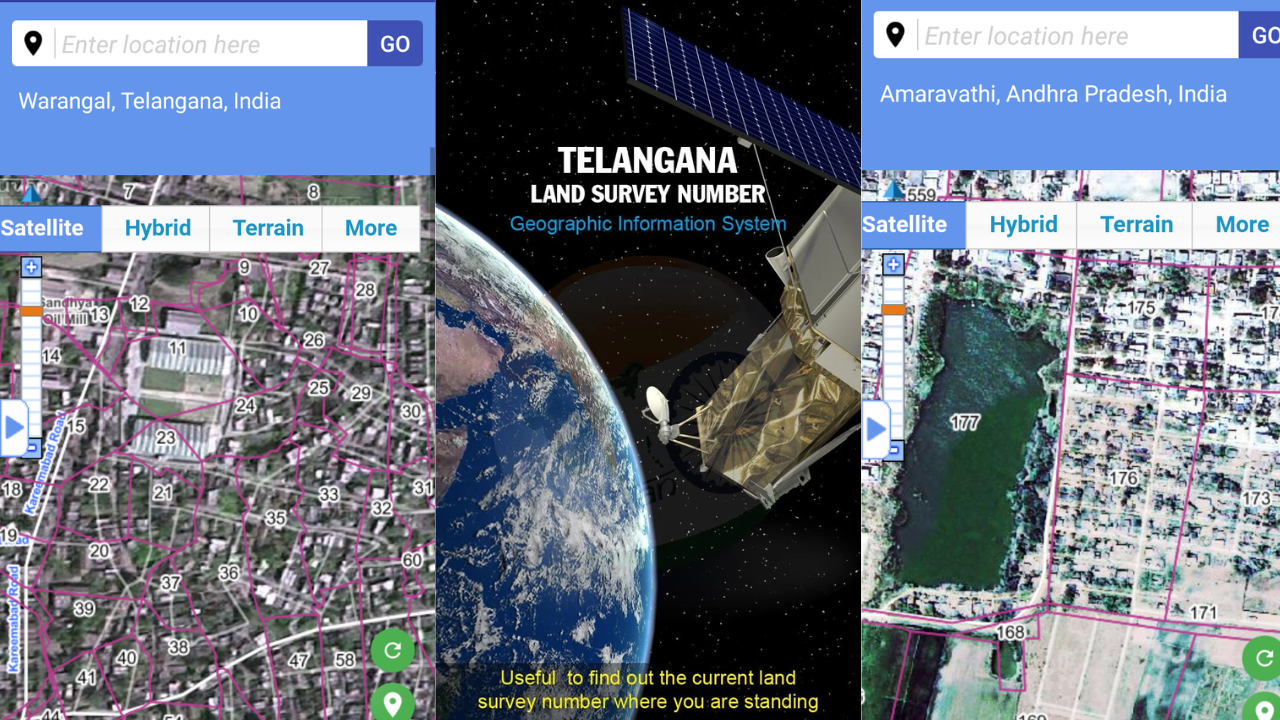
How to Find TS Land Survey Numbers Online
The Telangana government has made it simple for citizens to check their land details online. The official Dharani portal allows users to search for their land using various parameters such as district, division, mandal, village, or survey number. By entering the right details, users can instantly view ownership information, land classification, and extent of property directly from the official database.
Steps to Check Land Survey Numbers in Telangana
To check the TS land survey number, visit the official Dharani portal at https://dharani.telangana.gov.in. Once you open the website, navigate to the “Land Details Search” section. Select your district, mandal, and village, then enter the survey number or pattadar name. After submitting the details, the system will display your land record information, including the survey number and ownership details.
Benefits of TS Land Survey Numbers
TS Land Survey Numbers have brought many benefits to citizens and authorities. They help in verifying land ownership and boundaries quickly and accurately. Property transactions, agricultural activities, and legal procedures have become more transparent with easy access to digitized records. The system also reduces corruption and delays that were common in manual record maintenance.
Importance in Land Registration and Property Deals
Whenever a land sale or transfer takes place, the survey number is one of the most important details mentioned in the registration documents. It ensures that the property being transferred is clearly identified and avoids confusion over ownership. Buyers can also verify the authenticity of the land using the survey number before completing a purchase.
Role of Dharani Portal in Land Survey Management
The Dharani portal serves as the central platform for managing all land-related records in Telangana. It integrates land registration, mutation, and record management services. The system is designed to provide real-time updates and ensure that all data related to TS Land Survey Numbers is accurate and accessible to the public.
Download App – AP
Download App – TS
Land Site – TS
Land Site – AP
How Land Survey Numbers Help Prevent Disputes
Many land disputes arise due to unclear boundaries or multiple claims on the same property. The survey number system eliminates such issues by providing a clear and government-verified record of each land parcel. It defines the boundaries accurately through survey maps and ensures that ownership is well-documented.
Updating Land Survey Numbers and Records
In case of land division, sale, or inheritance, the land survey records must be updated to reflect the new ownership. The Dharani portal allows for easy mutation and record updates after proper verification. This keeps the database current and ensures that property transactions are legally valid and traceable.
Government Initiatives to Modernize Land Records
The Telangana government continues to improve its land record management system by adopting advanced technology such as GIS mapping and digital record verification. The goal is to make land record services completely paperless, fast, and transparent for citizens.